
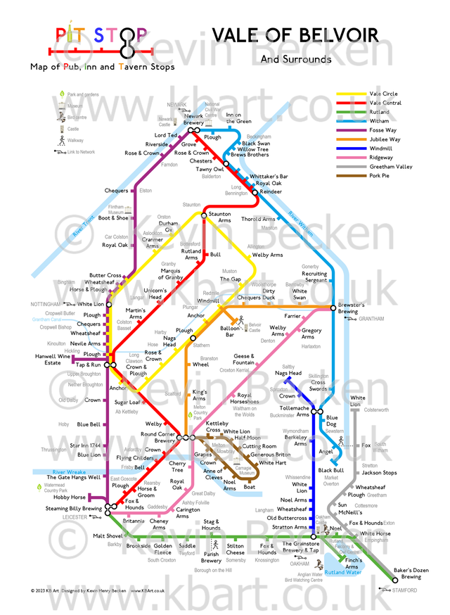
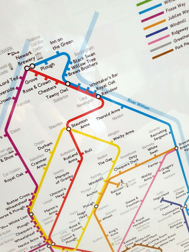
Vale of Belvoir PITSTOP map of Pubs, Inns and Taverns
£14.99
This map shows all the Pub, Inn and Tavern Stops in the Vale of Belvoir. It extends broadly from the Fosseway to the west, Newark to the north, A1/Grantham/River Wareham to the east, and Leicester-Rutland to the south. The "Lines" are given meaningful names which are explained.
The map is accompanied by a Certificate of Authenticity, signed by me the designer. This is an original design by me.
Edition 3.2 - Published August 2025
Size: A3 The map may be framed at A3 or may be trimmed to fit a 12x16 inch frame.
The map may be customised at your request for a fee. Custom maps are unique items and printed on-demand. Custom maps may be A4, A3, A2, A1, A0. Please contact me for an estimated cost.
Price includes delivery.
Framing may be possible, if you supply the frame to me and you can collect.
Any questions, please contact me: kevin.becken@kbart.co.uk
© Kevin Becken KBArt www.KBArt.co.uk
Share